A History of Pease Pottage
The Name
Pease Pottage is a dish made of peas, more commonly known nowadays as pease pudding, although pease pottage is likely to be its original name. This website includes a traditional recipe for pease pottage (or pease pudding or pease porridge).
The dish was supposedly fed to prisoners passing through the village, either travelling east and west between East Grinstead and Horsham, or north and south between London and Lewes. Neither route, however, is likely to have gone through Pease Pottage regularly.
An alternative story claims that pea-related sustenance was taken here by law-abiding citizens travelling between London and Brighton, although this too is unlikely; the name was first recorded long before a road linked Pease Pottage and Brighton.
A more persuasive explanation may be that the name refers to the texture of the muddy ground which would have characterised the area (see A.D. Mills, A Dictionary of English Place Names, Oxford University Press, 2011).
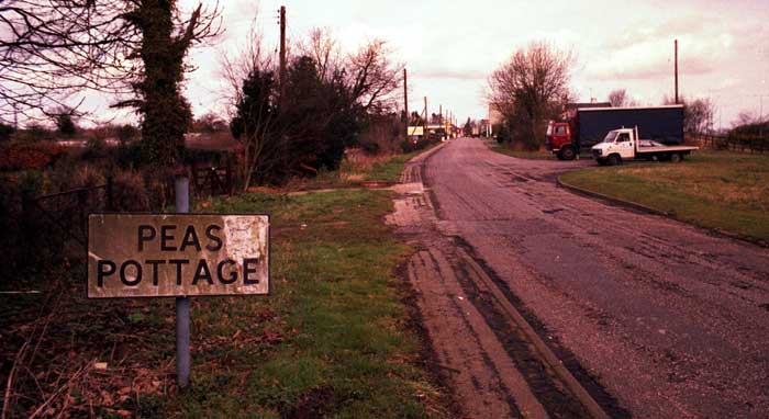
The name is first recorded in 1724, on Richard Budgen’s map of Sussex, as Peaspottage Gate. The Gate part of the name probably referred to the village’s location at an entrance to St Leonard’s Forest and Tilgate Forest, as is the case with the nearby villages of Colgate and Faygate.
The setting up of a turnpike in or shortly after 1771 led to a change in meaning: Peaspottage Gate came to refer to the tollgate rather than the entrance to a forest. The abolition of turnpikes in 1877 led to the shortening of the name to either Pease Pottage or Peas Pottage.
The two spellings were in use until the early 1990s, but the latter disappeared once the highway and postal authorities each settled on the current form.
Early Years
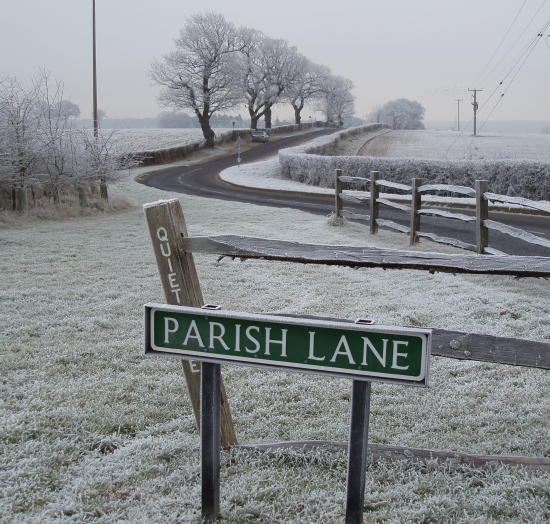
Pease Pottage is situated on a ridge leading eastwards from Horsham. Flint tools, found along Parish Lane, and traces of burial mounds further west, show that the ridge was in use thousands of years ago. The main ridgeway route between what are now Horsham and East Grinstead passed further south, through Handcross, although a short cut along what is now Parish Lane was used during the drier months.
The two earliest maps of the area, dating from 1575 and 1610, show no roads or structures where Pease Pottage now is. The first evidence of buildings is on Richard Budgen’s map of 1724, which also shows one road, running north to Crawley.
The Turnpike
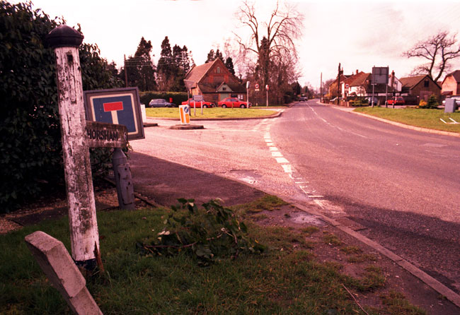
The main road south to Brighton was built in 1770, and a year or so later a turnpike was installed in the village, at the site of The Grapes pub, preying on traffic that passed east and west along what is now Horsham Road and Forest Road. Pease Pottage’s location at an increasingly busy crossroads led to its expansion.
Pease Pottage was part of the main route linking Horsham and Crawley until 1823, when a new road was built through Faygate on the site of what became the A264. The Pease Pottage turnpike was removed in 1877.
Later Developments
A county standard cricket ground existed alongside the London to Brighton road near Parish Lane from 1874 until 1939, when it was ploughed to assist the war effort. It is now the site of what is perhaps Pease Pottage’s most famous, though least glamorous, attraction: Bridges’ car scrap yard.
During the First World War, an army camp was set up on land between the Black Swan pub and Parish Lane, roughly where the Moto Service Station now is. You can see part of the camp in the distance in this photograph from the Slaugham Archives website, taken on Horsham Road, looking east.
There is no railway station in Pease Pottage, although the London to Brighton line, built in 1841, skirts the village just beyond the eastern end of Parish Lane. An old village tale says that on a calm moonlit night, the trains can sometimes be heard above the noise of the motorway traffic.
The village expanded throughout the twentieth century along with the increasing car traffic along the London to Brighton road. The Black Swan became a popular stop along the route, especially with coach parties.
Pease Pottage has had two churches. Until the early 1960s, a tin church existed immediately to the south of The Grapes pub. Its replacement, the Church of the Ascension, was a brick building opposite the Black Swan pub. It lasted for nearly half a century before the dwindling numbers of worshippers necessitated its conversion from spiritual to commercial and residential use. Here it is in 2013:
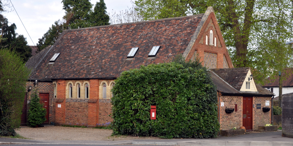
At the time of writing, the building contains the offices of Open Haus Kitchens. A commercial unit on the site of the original church was occupied for many years by Metric Screws, and more recently by the Pure Oyster Company.
For information about the general area of Pease Pottage, see the Victoria County History of Sussex, vol. 6, part 3, pp.16-21.
Modern Pease Pottage
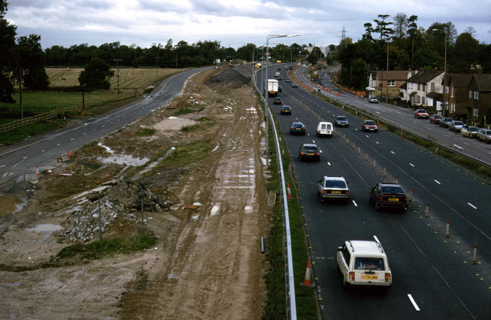
The creation of the M23 in the early 1970s involved the destruction of the ancient crossroads joining Parish Lane and Horsham Road to the London to Brighton road. The A23 was widened, lowered and moved slightly westward, with the original southbound carriageway reverting to its previous status as a single carriageway road to Handcross.
Under the ownership of the Horsham brewers, King and Barnes, The Black Swan pub changed its name for a few years to the James King, in honour of one of the founders of the firm. When King and Barnes were bought out and closed down in 2000, the pub reverted to its original name.
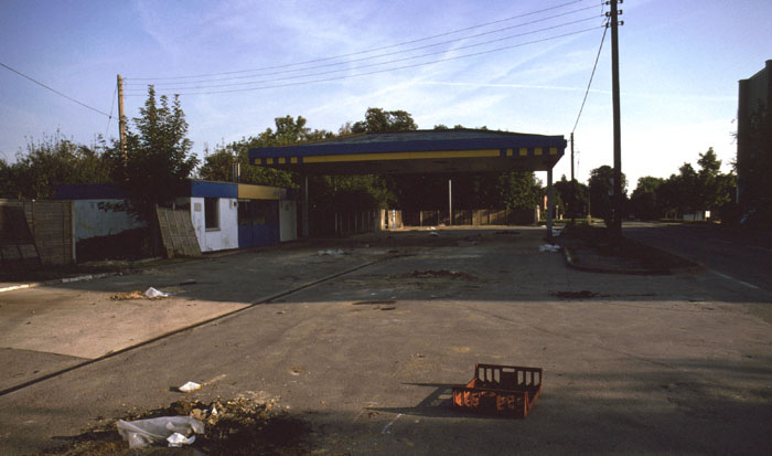
Numerous businesses have come and gone over the years, including at least two petrol stations, the last of which disappeared as a result of the construction of the motorway service station and the associated rerouting of the A23, which encouraged the London to Brighton traffic to bypass the village. This petrol station was built partly on the site of the Busy Bee restaurant, which burned down in the 1960s.
At the time of writing, Pease Pottage contains only two shops: the motorway service station and the community shop on the Woodgate estate, which opened in 2024. Several other shops used to exist within living memory, including:
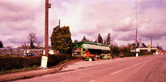
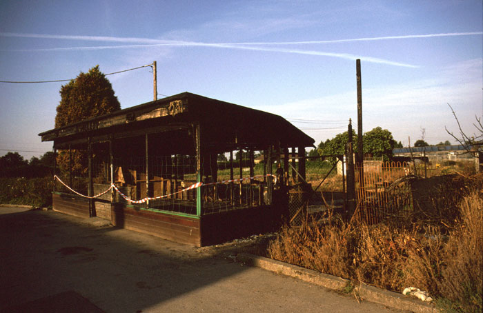
- T. Haynes, florist, which closed toward the end of 2024 and may, according to rumours, become a barber’s shop or a tattoo parlour. [Update: It’s a barber’s shop.]
- a shop at Hemsleys’ nursery, which doubled as a newsagent on Sundays;
- a newsagent on Tilgate Forest Row, previously a post office, and now a commercial office;
- a number of commercial buildings opposite the Black Swan, inlcluding a café and a garage, as well as a post office; see this photo and this photo from the Slaugham Archives website, both taken from the pub in 1950, and this photo, taken in 1916. All of these buildings were demolished in the 1970s and replaced by two large warehouses.
- One of those buildings was occupied in the late 1960s and early 1970s by Peter Bennett’s Sussex Speed Shop, which sold bolt-on parts for custom motorcycles. Mr Bennett was pictured on the front cover of Motorcycle Mechanics magazine, June 1970, at the side of the old A23 (you can download a PDF copy of the magazine from http://www.pdf-archive.com/2011/02/15/ashmotorcycle/ or https://manualzz.com/download/19132735 — many thanks to Jonathan Jones for this information).
One of the largest businesses, at least in terms of land area, was Hemsleys’ nurseries, opposite The Grapes pub. Sadly, the shop accidentally burned down one day, and planning permission was granted for two profitable housing estates. In 2006, The Hemsleys and The Squires estates were built on the land. To win over the locals, a village shop had been promised, and indeed required as part of the development, but once planning permission had been granted, it was forgotten.
There was a campaign for a hospital to be built in Pease Pottage, on the unused woodland at the top of Pease Pottage Hill, between the A23 and the M23. The campaign was ultimately unsuccessful, but it attracted attention when someone noticed that a domain name formerly used for the campaign’s website, c4pph.org, had expired and been taken over by a German porn site. The two local MPs were unaware of this, and carried links to the dodgy Teutonic electronic frolics on their own websites. One of the MPs happened at the time to be responsible for the government’s digital strategy.
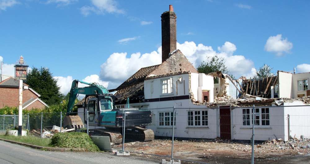
The Grapes closed its doors in September 2008. Its owners, Hall and Woodhouse, at first intended to convert the building for residential use, but later decided to demolish it, and the Grapes was pulled down in September 2010. Six houses were built on the land in 2013.
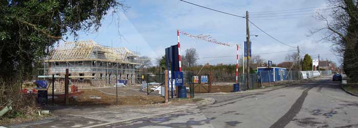
Early in 2019 a very large housing estate, known as Woodgate, began to be built on the site of the Pease Pottage Car Boot Sale. The same year, a new community centre was opened on Finches Field. It was named MacNaughton Hall, after the long-serving local councillor and resident of Horsham Road, Andrew MacNaughton. There is a photograph of the new hall on the Photo Gallery page, which also contains a record of the Woodgate development.